

Black Mountain [Clermont Cairn]
Good walks are even better shared.
Overview
Discovering Black Mountain [Clermont Cairn]
Overview
Located in the enchanting Brecon Beacons National Park, Black Mountain, or Mynydd Du, stands proudly at 720 meters. Despite its name, it’s not “black” in a gloomy sense; rather, it’s a gem of beauty waiting to be explored.
Geology
This mountain is primarily formed of old red sandstone, making it a geological wonder itself. The rock formations tell tales of ancient rivers and natural forces that shaped the landscape—perfect for the budding geologist in you!
The Route
The most popular route begins at the Cwm Tŵr car park. From there, hikers can enjoy an invigorating trek through rolling heather-covered slopes. The route includes ups and downs that may have you wishing you could just fly to the top!
Key Details:
- Distance: 5.5 km
- Time: Approximately 2.5 hours
- Difficulty: Moderate
Summit Features
Crest the peak and be greeted by a magnificent stone cairn. The summit offers breathtaking views of the surrounding mountain ranges—perfect for that epic selfie! Don’t forget to capture the moments; believe us, your friends at home will be green with envy.
Terrain Type
Expect a rocky trail with grassy patches and a few boggy sections. Make sure to wear sturdy boots unless you fancy a refreshing dip!
Views
On a clear day, the vistas from Black Mountain are unforgettable. Notable landmarks include the Black Mountain range and the distant, rolling hills of Pembrokeshire. The best seasons to experience these views are spring and autumn, when nature puts on its best shows.
Hazards
Be aware: The weather here can change faster than you can say ‘What a beautiful day!’ Slippery rocks and muddied paths are not uncommon after a good downpour, so tread carefully.
Nearby Summits
If you’re up for a challenge, consider tackling nearby peaks like Fan Brycheiniog (802m) and Fan Nedd (634m), both offering their own distinct views and trails.
Access
Getting here is easy, just take the winding roads to Cwm Tŵr car park. However, getting to the trailhead without a car can be a bit of a pickle, as public transport options are scarce.
Facilities
While there are no facilities on the mountain itself, nearby Llandeilo has a variety of cafes and shops to refuel after your adventure. It’s a great spot for a post-hike cream tea!
Historical Significance
The name “Black Mountain” harks back to the Old Welsh ‘Mynydd Du’. This mountain has been a staple for early Welsh settlements and remains a central spot for grazing sheep.
Embrace your inner adventurer and experience the majesty that is Black Mountain. Just be sure to pack an extra sandwich or two—you might end up on summit watch a bit longer than anticipated!
Explore routes near Black Mountain [Clermont Cairn]
Public walks starting within 80 km of this hill. Nearby does not mean a route reaches the summit; check its map and access before setting out.
Silent Valley to Ben Crom Dam: Reservoir Road Walk, County Down
View route
Scarva to Poyntzpass: Newry Canal and Lough Shark Return
View route
Tollymore Forest Park: Mountain and Drinns Trail
View route
Tollymore Forest Park: River Trail near Newcastle
View route
Route planning notes
These notes describe possible approaches, not verified navigable routes or permission to cross land. Check current paths, local access rules and conditions before setting out.
Cwm Tŵr to Summit Route
A scenic route starting from Cwm Tŵr that winds through heather-covered slopes before ascending the final stretch to the summit.
Make a day of it, together
Find someone to share the walk with, or organise a day out along a route you like.
Photo Gallery
View all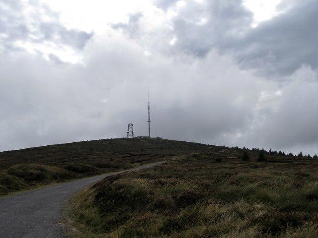 Photo could not load
J0915 : RTE Clermont Transmission Mast on Black Mountain
Eric Jones
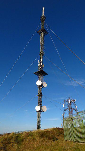 Photo could not load
J0915 : Clermont Carn transmission site on Black Mountain, Co Louth
Colin Park
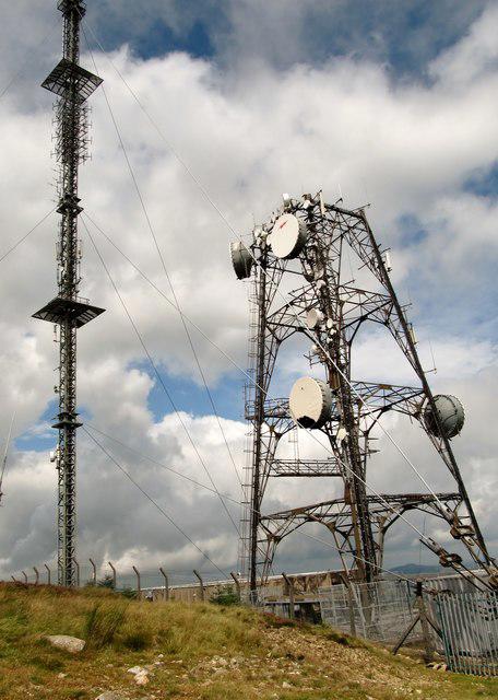 Photo could not load
J0915 : RTE transmitter and telecommunications mast at Clermont
Eric Jones
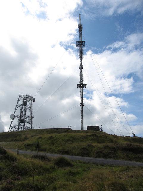 Photo could not load
J0915 : The Clermont Carn masts and service road
Eric Jones
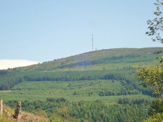 Photo could not load
J0915 : RTE television and radio transmitter masts on Clermont Carn
Eric Jones
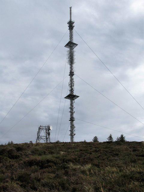 Photo could not load
J0915 : Clermont masts from the north
Eric Jones
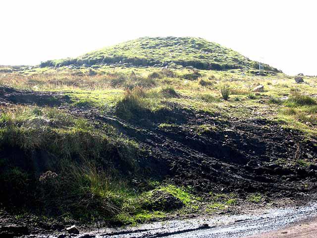 Photo could not load
J0915 : Clermont Cairn
Oliver Dixon
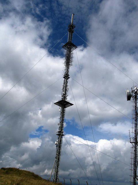 Photo could not load
J0915 : Transmitters at Clermont Carn
Eric Jones
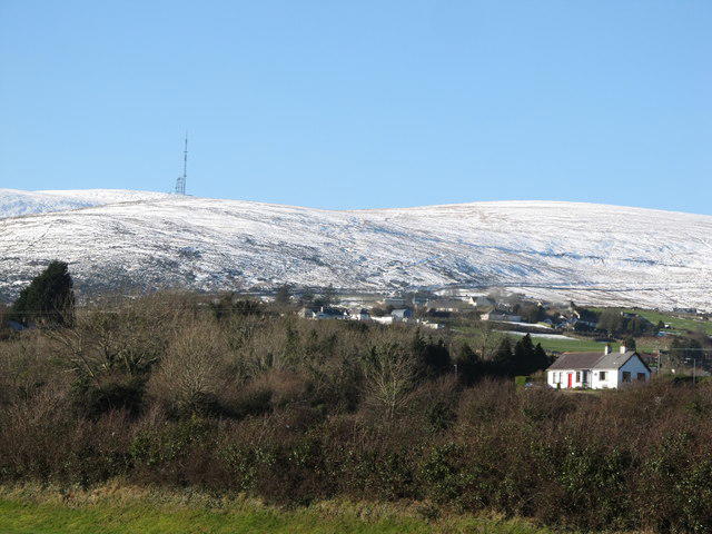 Photo could not load
J0915 : The Clermont Cairn RTE television and radio transmitters on Black Mountain viewed from Omeath
Eric Jones
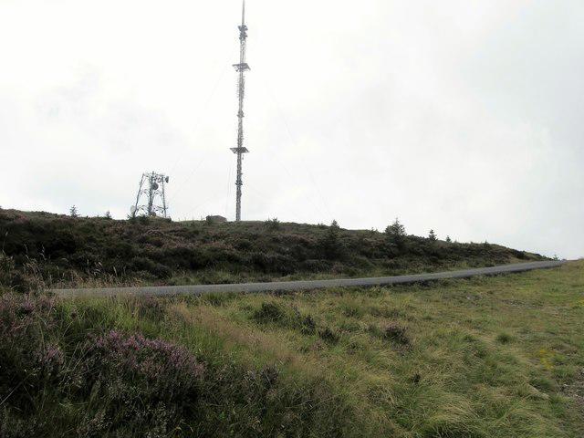
J0915 : Clermont Carn Masts viewed across the service road
Eric Jones
Hill facts and local notes
Classifications
Elevation
507m
1,663 ft
Prominence
309m
Coordinates
54.0793, -6.3216
J099157
OS Map
29 36
At the Summit
The summit is marked by a prominent stone cairn, affording panoramic views of the surrounding hills and valleys.
Terrain & Geology
Primarily composed of old red sandstone, Black Mountain features undulating hills and distinctive rock formations, remnants of ancient river systems.
Views & Scenery
On a clear day, you can see the peaks of the Black Mountain range, the Brecon Beacons, and even the distant hills of Pembrokeshire.
History & Heritage
Name Origin
Black Mountain derives its name from the Old Welsh 'Mynydd Du', referring to its dark, rugged terrain.
Historical Significance
The area has historical significance as a site for early Welsh settlements and has been a grazing ground for centuries.
Getting There & Facilities
Check current local access restrictions, parking rules and transport timetables before travelling. These notes do not confirm public access to the summit.
Parking
Cwm Tŵr car park, which has space for approximately 20 vehicles. Arrive early during weekends to avoid disappointment.
Public Transport
Public transport options are limited; it's advisable to use car services or taxis from nearby towns.
Nearby Facilities
No facilities on the mountain; however, cafes and shops can be found in Llandeilo, approximately a 20-minute drive.
Safety Information
Known Hazards
- Watch out for sudden weather changes, especially in winter. Slippery rocks can be treacherous when wet.
General Safety Tips
- Check weather conditions before setting out
- Carry appropriate clothing and equipment
- Let someone know your planned route
- Take a map, compass, and GPS device
- Carry emergency supplies: food, water, first aid kit, torch
Hills
Some common questions about the hills answered
Are there group walks up Black Mountain [Clermont Cairn]?
Many walkers use Walkmates to join or organise walks with others. You can check for group walks around Black Mountain [Clermont Cairn] through the maps
Are there other walkers around Black Mountain [Clermont Cairn]?
Activity varies by location and time, but Walkmates lets you see whether others have shared walks or shown interest in this area. Find other people through the walking friends search walking friends for Black Mountain [Clermont Cairn] search or of course create your own walk for Black Mountain [Clermont Cairn]
Can I organise a walk to Black Mountain [Clermont Cairn]?
Yes. If there aren’t any walks listed already, you can create a walk and make it available for others to join.
If you're signed up to Walkmates, you can create a walk to Black Mountain [Clermont Cairn].
How do I find a walk up this hill?
There are often multiple ways to walk this hill, depending on experience and route preference. Walkmates helps you explore walks and routes that others have shared.
Can I suggest a new route up Black Mountain [Clermont Cairn]?
Yes. You can suggest or create routes to share with others. Walkmates focuses on the social side of walking, so routes are used to help people organise walks and explore areas together, rather than as detailed navigation tools or route libraries.
Other uses really appreciate knowledgeable walkers sharing their routes. Share your favourite route to Black Mountain [Clermont Cairn] here
The is an error or something incorrect about this hill. How do I let you know?
We always strive to keep the information on Walkmates as accurate as possible. If you find an error, please let us know through the contact form and we'll aim to correct it as quickly as possible
Community Discussion
Comments
Location
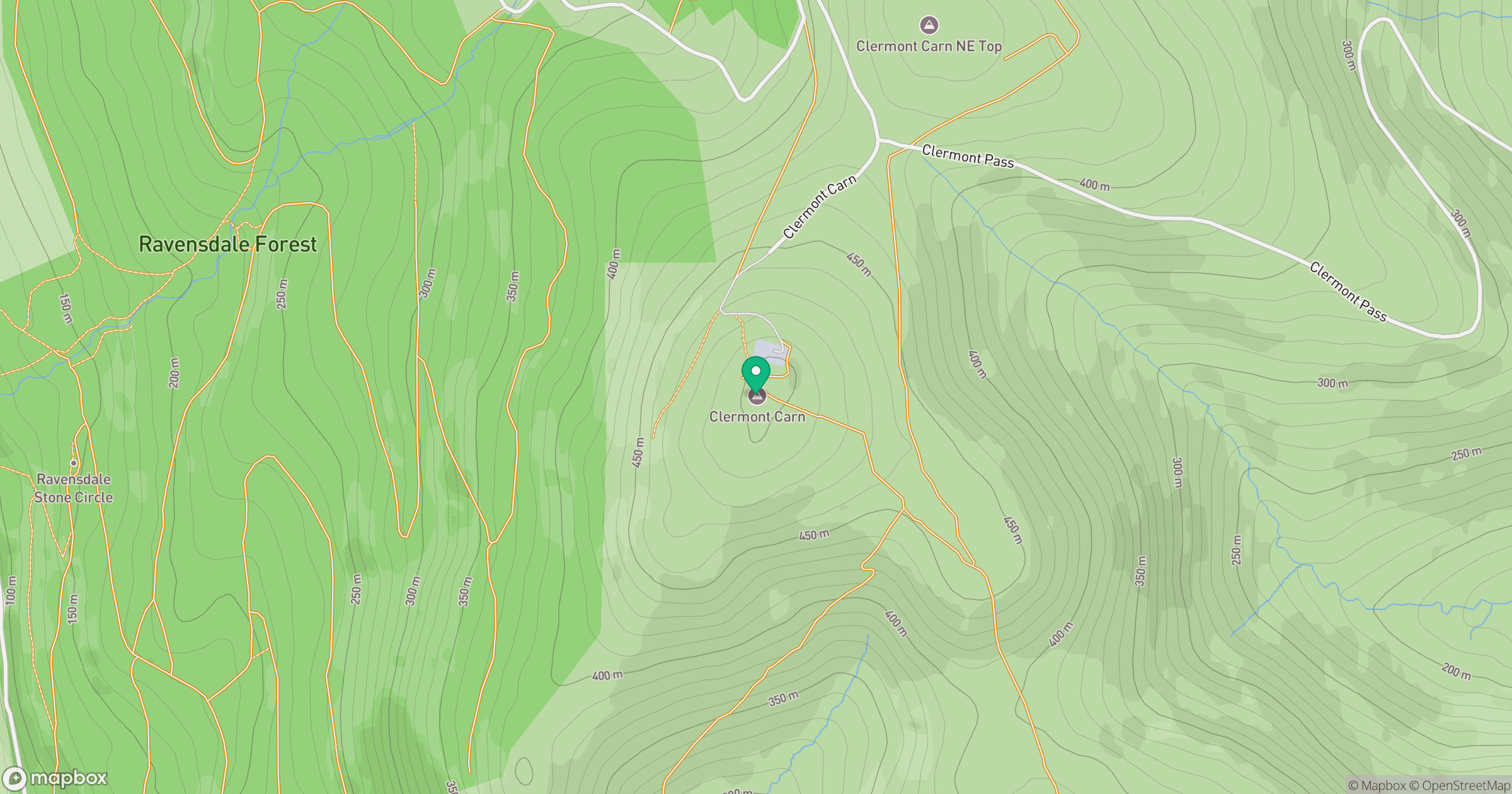
Grid reference: J099157
View on OpenStreetMapOpens a map in a new tab, centred on the hill.
Hills within 30 km
Straight-line distance, not a walking route or confirmation of access.
No comments yet. Be the first.